
What Exactly Is LiDAR?
LiDAR, short for Light Detection and Ranging, is a sophisticated remote sensing technology that measures distances by emitting high-powered lasers and capturing the reflections of light. It essentially functions like a supercharged version of radar but uses light instead of radio waves.
To perform its magic, LiDAR sends out a laser pulse towards an object. It then measures the time it takes for the light to bounce back and calculates the distance based on the speed of light. This highly precise data is used to construct detailed 3D models of the environment. Imagine it as a digital sculptor that carves out a 3D representation of the world based on laser feedback.
 Flyability's Elios 3 equipped with a glowing green LiDAR sensor as it navigates a water treatment facility
LiDAR technology finds applications across a broad spectrum of industries, from aerial mapping to autonomous vehicles. Its ability to be mounted on drones has made it particularly valuable in hazardous situations where human intervention could be risky.
Unpacking the Acronym: LiDAR
LiDAR, which originally stood for "Light Detection And Ranging," is a cutting-edge method of gathering spatial data using advanced lasers and light-based technology. It allows for the creation of precise 3D models by sending out laser pulses and analyzing the reflected light.
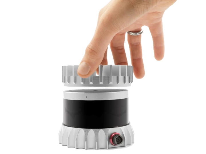
An Ouster OS0-32 LiDAR sensor
The concept of LiDAR dates back to the early 1960s when scientists began experimenting with lasers and their potential applications. Initially, LiDAR was used for mapping small rivers and streams. However, the integration of GPS in the 1980s transformed LiDAR into an indispensable tool for large-scale geographical mapping and topographical studies.
In its infancy, LiDAR systems were bulky, cumbersome, and often inaccurate. They required manual operation and were typically mounted on large, manned aircraft, making them costly and somewhat impractical. Fast forward to today, and LiDAR has become significantly more compact, affordable, and accessible. Even consumer electronics like the latest iPhones now feature LiDAR scanners capable of generating 3D models from up to 15 feet away.
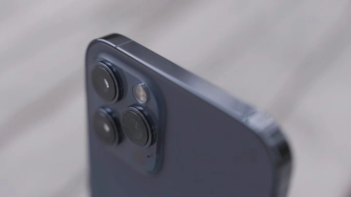
LiDAR sensors combined with visual sensors on a smartphone
With such rapid advancements, LiDAR technology has evolved dramatically since its inception. But how exactly does it work?
How Does LiDAR Operate?
No matter the platform—a drone, a plane, or even a handheld device—LiDAR systems all share the same basic principle: they emit a high-intensity laser pulse at a target and measure the returning reflection. The laser pulses are directed at objects, whether they're trees, rocks, buildings, or the Earth's surface, and the reflected signals are captured and analyzed.
 An infrared image of a LiDAR sensor | Credit: Ouster
LiDAR is fundamentally similar to radar and sonar, except it relies on light rather than radio or sound waves. By combining the direction of the emitted light, the position of the scanner, and the distance between points, LiDAR systems can precisely determine the 3D coordinates of every reflective surface.
Every LiDAR system comprises three essential components:
1. The Laser
Although the color and intensity of the laser vary depending on the application, all LiDAR systems include a powerful laser. These lasers send out beams of light toward objects, which reflect the laser back to the sensor for measurement.
2. The Scanner
For the reflected pulses to be effectively captured and measured, LiDAR systems require a scanner, also known as a sensor or receiver. Depending on the specific task, the scanner may employ different types of lenses and optics. Common devices for collecting return signals include beam splitters and hole mirrors.
3. Global Positioning System
Accurate positioning is crucial for LiDAR systems to measure distances correctly. As such, most LiDAR systems incorporate state-of-the-art positioning and navigation systems to determine the absolute position and orientation of the sensor. Other hardware considerations, such as batteries, imaging systems, data collectors, and aircraft, will vary based on the specific application.
LiDAR Formula
The entire process of emitting a laser pulse, receiving the reflection, and calculating the distance can be expressed mathematically as:
d = c * t / 2
In this equation, each symbol represents:
- d is the distance
- c is the speed of light
- t is the time of flight
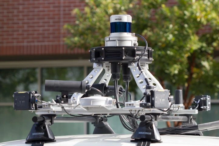
 An Ouster LiDAR sensor attached to a car
Advantages of LiDAR
LiDAR offers numerous advantages over other 3D modeling techniques, such as photogrammetry. For starters, it is incredibly precise, with some systems capable of targeting objects as small as individual molecules or as large as entire clouds.
Photogrammetry, which involves processing millions of photos to generate a single model, is far more data-intensive and generally less accurate than LiDAR. Additionally, LiDAR excels in low-light conditions or areas with poor visibility. Unlike photogrammetry systems, which falter in dark environments like mines or stormy skies, LiDAR operates effectively thanks to its use of infrared lasers.
This capability is critical in industries like public safety and emergency response, where accurate data collection is essential for life-saving operations. Other benefits of LiDAR include:
- Automation of large portions of work
- Data collection from diverse sources
- Decreasing costs as technology advances
 A LiDAR sensor mounted on a self-driving car
Categories of LiDAR
LiDAR systems can be classified based on several factors. One key distinction lies in the type of laser used. While there are countless variations of lasers with different strengths and ranges, a major difference is whether the LiDAR laser is topographic or bathymetric:
- Topographic LiDAR: The more common type, it employs a near-infrared laser to map land, trees, buildings, and more.
- Bathymetric LiDAR: The less common type, it uses water-penetrating green light to measure features like seafloor depth and riverbed elevations.
Another way to categorize LiDAR systems is by their orientation—whether the laser and sensor are positioned downward, upward, or laterally relative to the object being measured:
- Oriented to nadir: Looking downward. Example: LiDAR altimeters.
- Oriented to zenith: Looking upward. Example: Some atmospheric LiDAR instruments oriented upward.
- Oriented laterally: Looking sideways. Example: Many self-driving cars use laterally-oriented LiDAR sensors.
Orientation provides a practical way to classify LiDAR systems and helps differentiate between technologies with very different purposes.
Platform
Another important classification is the platform on which the LiDAR system is designed to operate. Will it primarily be used aerially or terrestrially? Depending on the answer, the technology will vary significantly in terms of hardware, coverage area, and sensor range.
Aerial LiDAR systems can be further divided into drone-based LiDAR, helicopter/airplane LiDAR, and satellite LiDAR. This distinction is useful because it categorizes LiDAR types not by their function but by the vehicle carrying the payload.
Applications of LiDAR
Having explored what LiDAR is, how it works, and the different types available, let's delve into the myriad industries that are currently leveraging LiDAR technology.
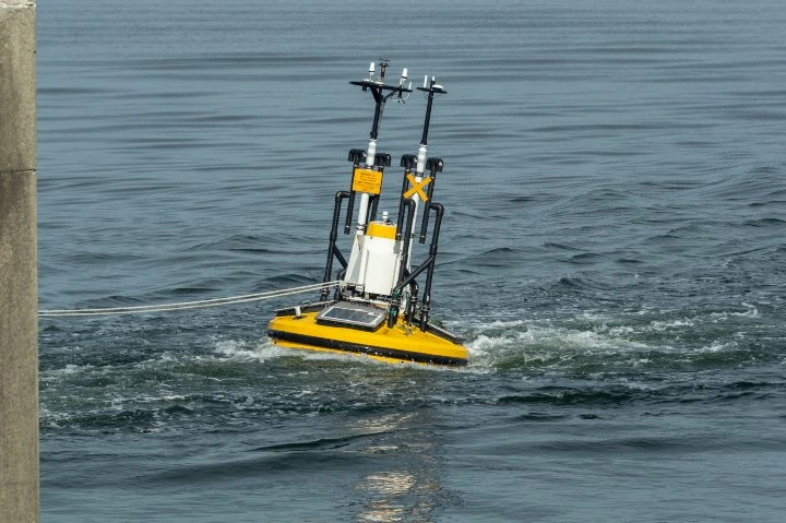
A LiDAR sensor mounted on an aquatic platform
Here are 12 of the most common LiDAR applications.
1. Accident Scenes
Whether it’s a late-night multi-car pileup on the highway or a crash on a snow-covered country road, LiDAR systems can swiftly capture extensive visual data before emergency responders even arrive. This allows first responders to focus on saving lives rather than assessing the scene.
Data collected by LiDAR can also serve as objective, data-driven evidence in court to help determine the cause or effects of an accident. Cleanup crews and tow trucks responding to the aftermath of an incident can also benefit from such detailed models.
2. Agriculture
LiDAR technology plays a pivotal role in modern farming. It can monitor crop yields, measure floodwaters to help position levees, and even track herds of livestock. Advanced LiDAR setups can even detect individual insects on a farm.
3. Atmosphere
When it comes to atmospheric research, LiDAR scanners, particularly those operating aerially, offer numerous benefits and use cases. These include pollution modeling, cloud profiling, meteorology, and studying the density and distribution of gases and molecules.
4. Archaeology
In 2017, LiDAR drone sensors uncovered a vast network of ancient roads in the El Mirador river basin, a dense jungle region in Central America. This discovery, which included Mayan roads dating back to 600 B.C.E., might have remained hidden without LiDAR's ability to penetrate thick tree canopies.
5. Conservation
Several U.S. states are utilizing LiDAR-enabled technology to better manage and conserve their natural resources. LiDAR drones and scanners are employed to measure forest heights, sand dune densities, and other critical metrics. They are especially beneficial in water conservation, where high-fidelity floodplain and river basin models derived from LiDAR surveys help governments prepare for natural disasters and predict annual resource needs.
6. Inspections
Equipped with LiDAR payloads, drones can access hazardous or inaccessible areas, making them invaluable for inspections and maintenance. From gauging vegetation growth around power lines to conducting preliminary site surveys, LiDAR-equipped tools can drastically reduce the time and cost of manual inspections.
7. Insurance
LiDAR’s ability to rapidly survey large urban areas makes claims assessment, one of the costliest and most time-consuming aspects of the insurance industry, far more efficient. By using LiDAR to assess flood damage or analyze tornado paths, insurers worldwide can provide accurate, affordable quotes based on data precise to within six inches.
8. Forestry
LiDAR is exceptionally adept at measuring the height and location of individual trees in dense forests. Its ability to navigate through tree canopies also makes it ideal for collecting ground-level data. Traditional surveying methods are slow, inefficient, and nearly impossible without light, whereas LiDAR-equipped technology enables foresters to map vast tracts of forest with unprecedented speed and accuracy. This benefits both conservation efforts and industries reliant on forests, such as paper production and furniture manufacturing.
9. Law Enforcement
Since the turn of the century, police departments globally have replaced traditional radar guns with LiDAR speed guns, utilizing the technology's precision to measure vehicle speeds more accurately. Beyond speed enforcement, LiDAR is used by law enforcement to gather intelligence on suspects, inspect hostile territories, and provide aerial perspectives during hostage situations.
10. Mining
In the mining sector and geological sciences, LiDAR can assess post-detonation safety, estimate ore volumes, and study fault lines. It also aids in monitoring extraction spaces and detecting geological anomalies.
11. Transportation
LiDAR scanners in the transportation industry assist in every phase of development, from planning parking lots and rail lines to real-time traffic management and route adjustments.
12. Self-Driving Cars
Autonomous vehicles rely heavily on lateral LiDAR systems for obstacle detection and collision avoidance. Certain LiDAR configurations also support adaptive cruise control, navigation, and parking assistance.
China manufacturer is specialized in Stainless Steel Wire Rope Assemblies,Stainless Steel Cable Assembly,Galvanized Steel Cable Assembly,Stainless Steel Wire rope slings,inox cable sling. Stainless Steel Wire Rope Assemblies,Zamak End,China zinc cast end,eye-eye wire rope sling etc.
construction : 7x7,6x7+fc,6x7+iws,6x19+IWS,6x19+FC,7x19, 1x19 and so on.
diameter: from 1.0mm to 12mm.
Length : 1m,2m,3m,4m,5m,6m,8m,10m, can according to your request.
Tensile strength:1570N/mm2,1770N/mm2
we can make the wire rope sling according to your samples,drawing or inquiry.
We follow very strict incoming and outgoing QC procedures and have our own in-house inspection equipment, such as Spectrometers, Load testing machines, salt spray booth, along with being ISO9001 certified.
Please do not confuse Ruijin Co.ltd with other Chinese manufacturers, we strive to offer the very best quality product along with unparalleled customer service. We would welcome the opportunity to discuss your current and future requirements, and warmly invite you to visit our facility.
Wire Rope Slings For Lamp,Steel Wire Rope Sling For Lamp,Wire Rope Slings,Light Wire Rope Sling
JIANGSU RUIJIN SLING CO.,LTD. , https://www.cnsteelcable.com